
Mapping India’s Sacred Geography — Pilgrimage Networks
Aim
To mark the main pilgrimage networks, the chār dhām, the jyotirlingas and the Kumbh Mela sites, on an outline map of India, and to notice the pattern they make across the Subcontinent.
Apparatus
- An outline political map of India and an atlas
- Coloured pencils or sketch pens
- A ruler and a pencil
Procedure
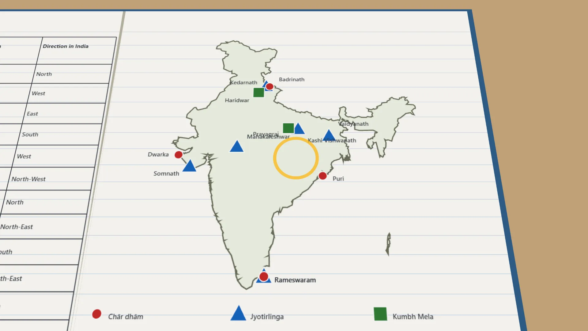
- Mark the four chār dhām sites, Badrinath, Dwarka, Puri and Rameswaram, with a red dot and label each one.
- Using an atlas, mark six of the 12 jyotirlingas with a blue triangle.
- Mark the four Kumbh Mela sites, Haridwar, Prayagraj, Nashik and Ujjain, with a green square.
- Make a legend showing the symbol for each network.
- Join the four chār dhām points with straight lines and look at the shape.
- In the table, record each site's state or region and the direction in India where it lies.
Interactive 3D Experiment
Loading simulation…
What to observe
- The four chār dhām sites lie near the north, west, east and south of India.
- The jyotirlingas and the Kumbh Mela sites are spread across the whole Subcontinent.
- Together the networks link every region of India.
Notes
- Use an atlas to check each location before you mark it. Keep the legend consistent and easy to read.