
Constructing a Political Timeline and Comparing Territorial Maps
Aim
To make a timeline of the major dynasties and events of the 13th to 18th centuries, and to compare how much land the Delhi Sultanate, the Vijayanagara Empire, the Bahmani Sultanate and the Mughal Empire ruled, using outline maps.
Apparatus
- A long strip of chart paper or graph paper
- A ruler and a pencil
- Coloured pencils or sketch pens
- Three outline maps of India
- An atlas for reference
Procedure
- On the chart-paper strip, draw a timeline from 1200 to 1800 CE, with a mark every 40 years.
- Mark the first six events, from 1206 (Delhi Sultanate) to 1498 (Portuguese arrive).
- Mark the later events, from 1526 (First Battle of Panipat) to 1799 (Sikh Empire).
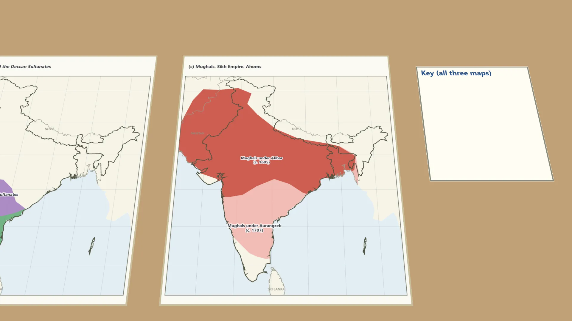
- Shade and label three maps: (a) Tughlaqs, Lodis; (b) Vijayanagara, Deccan; (c) Mughals, Sikhs, Ahoms.
- Make one common key, with the same colour for a power on every map.
- Compare the three maps and fill in the table.
Interactive 3D Experiment
Loading simulation…
What to observe
- Under the Tughlaqs (about 1335) the Delhi Sultanate ruled most of India; by the Lodis (1526) it held only the north.
- In the south, the Vijayanagara Empire and the Bahmani (later Deccan) Sultanates were rivals across the Krishna river.
- The Mughal Empire grew from Akbar to Aurangzeb, until it covered almost all of India.
- The Ahoms kept Assam free (Saraighat, 1671), and the Sikh Empire rose in Punjab after the Mughals weakened.
Notes
- Social Science Spark: from 1206 to 1526, five dynasties - the Mamluks, Khiljis, Tughlaqs, Sayyids and Lodis - ruled the Delhi Sultanate, with hardly nine years per sultan on average.
- Use a sharp pencil for clean timeline marks.
- Keep the key the same on all three maps, so that the comparison is clear.
- The regions are approximate, following the usual NCERT maps; the textbook's figures are not on the lab-manual page.