
Mapping the Growth of an Empire: From Nanda to Maurya
Aim
To compare the territorial extent of the Nanda Empire and the Maurya Empire using outline maps of India, and to find the geographical and other factors that helped Magadha grow into an empire.
Apparatus
- Two outline maps of India
- Reference maps (Fig. 5.12 Nanda Empire and Fig. 5.13 Maurya Empire) from the textbook or an atlas
- Coloured pencils
- A ruler
- Tracing paper (optional)
Procedure
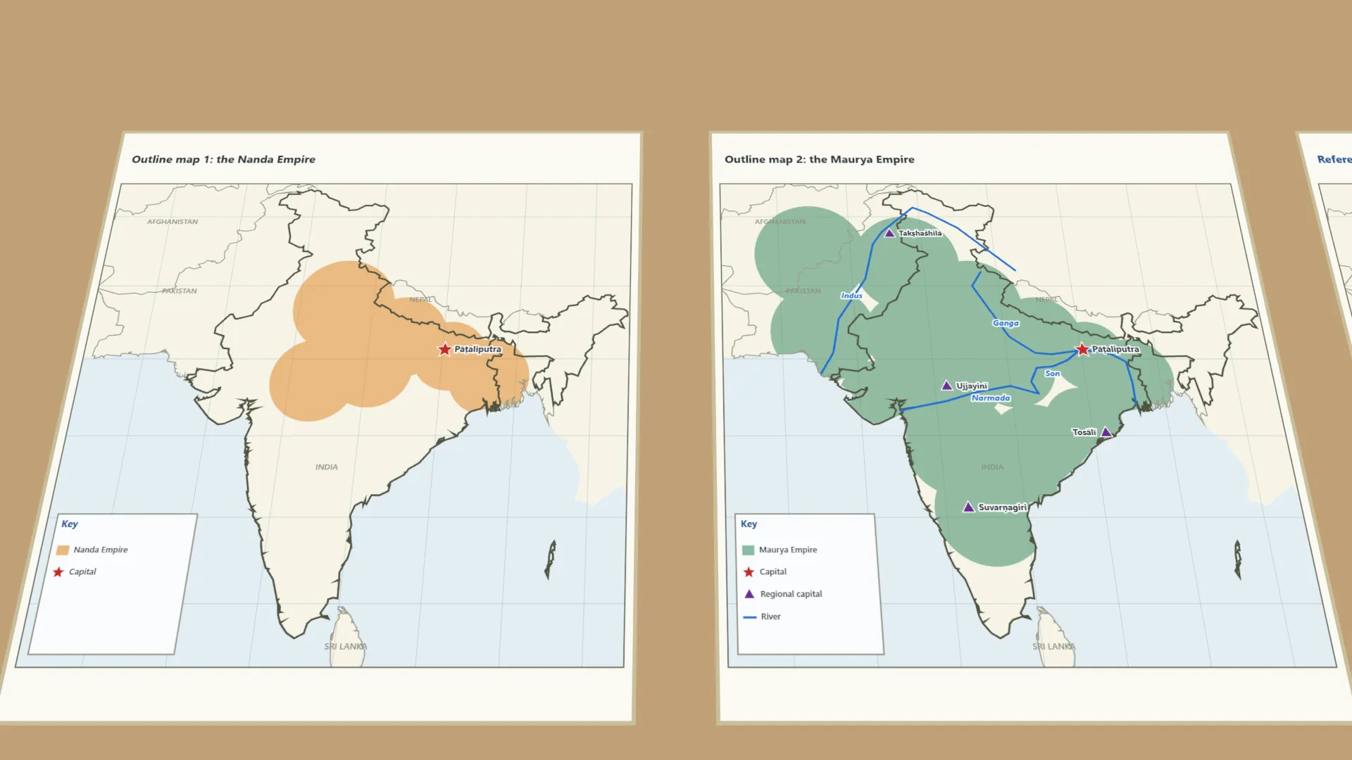
- On map 1, shade the Nanda Empire in one colour. Mark the capital, Pāṭaliputra, with a star.
- On map 2, shade the Maurya Empire in another colour. Star Pāṭaliputra; mark regional capitals with triangles.
- On the Maurya map, draw the Ganga, Son, Indus and Narmada in blue - routes for trade and transport.
- Compare the maps. List three regions in the Maurya Empire but not in the Nanda Empire.
- List two geographical advantages that helped Magadha become a strong kingdom.
- Record your observations in the table.
Interactive 3D Experiment
Loading simulation…
What to observe
- The Nanda Empire covered the Ganga plains, from Bengal to the Punjab, and parts of central India.
- The Maurya Empire stretched from Afghanistan to Bengal and south into Karnataka - most of the subcontinent.
- Both empires ruled from the same capital, Pāṭaliputra, where the Ganga and Son rivers meet.
- Fertile land, iron ore, forests with elephants and rivers helped Magadha grow strong.
Notes
- Social Science Spark: the Nanda and Maurya Empires both had Pāṭaliputra as their capital. Its place, where the Ganga and Son meet, kept it important across dynasties.
- Shade lightly so place names stay readable.
- Use the same base map for both empires so the comparison is fair, and label the key clearly.
- The empires' extents are approximate, following the NCERT maps; the textbook's figures are not on the lab-manual page.