
Mapping the World’s Physical Features
Aim
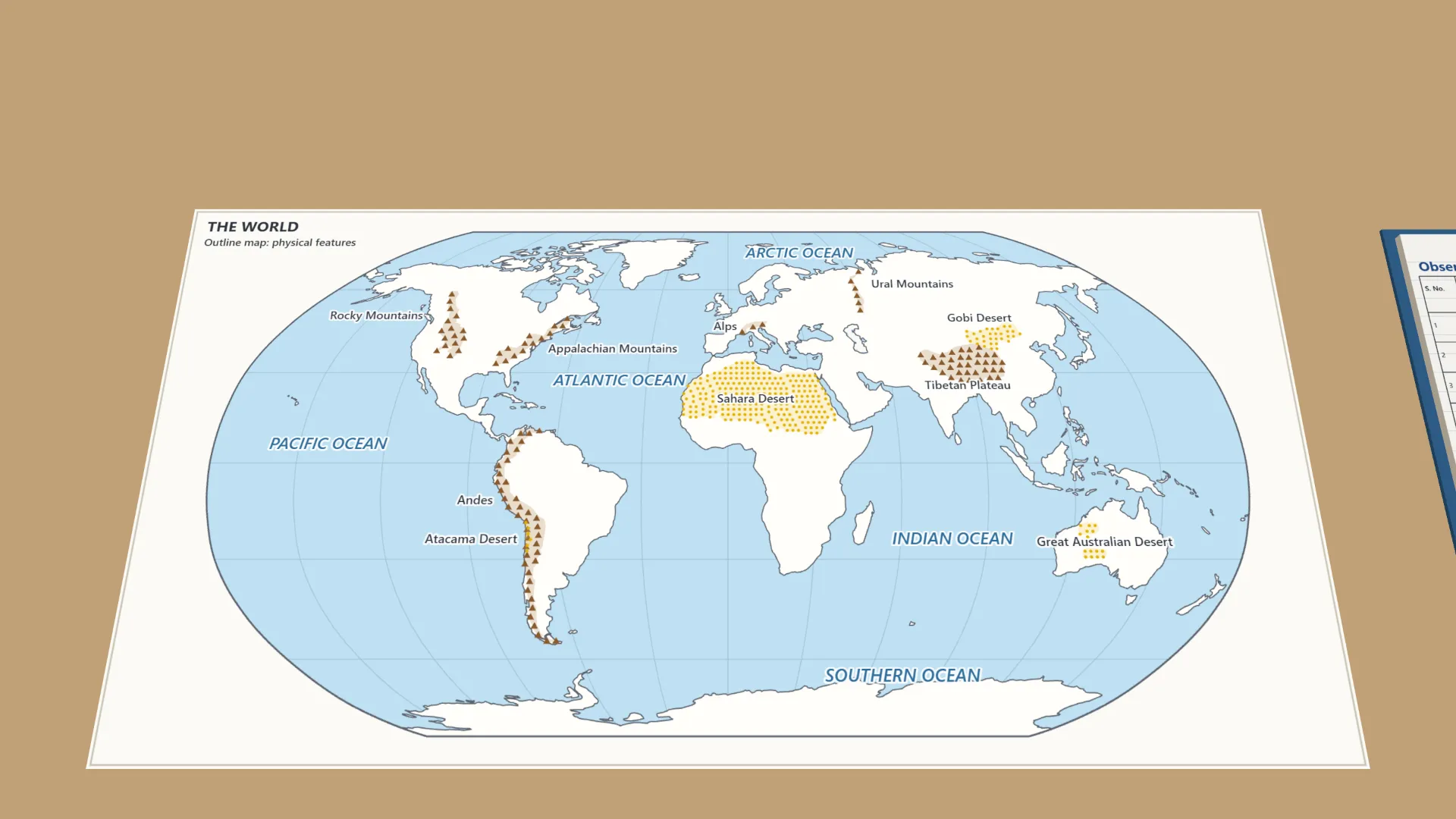
To make a labelled outline map of the world showing the five oceans and the major mountains, plateaus, deserts and rivers, using symbols and a key.
Apparatus
- A blank outline map of the world
- An atlas
- A pencil, coloured pencils and a ruler
Procedure
- Find and label the five oceans (Pacific, Atlantic, Indian, Arctic, Southern). Colour each light blue.
- Mark the highlands with brown triangles: Urals, Alps, Andes, Rockies, Appalachians, Tibetan Plateau.
- Mark the deserts with yellow dots: Gobi, Sahara, Atacama and the Great Australian Desert.
- Trace the Nile and the Amazon with a blue line. Add a small arrow for the direction of flow.
- Make a key in one corner of the map that explains every symbol and colour.
- Check the labels and the key with a partner for accuracy.
Interactive 3D Experiment
Loading simulation…
What to observe
- The Pacific is the largest ocean. The Southern Ocean surrounds Antarctica and the Arctic Ocean surrounds the North Pole.
- The Andes and the Rockies run along the west side of the Americas. The Appalachians are in the east of North America.
- The Atacama lies beside the Andes, and the Sahara covers most of North Africa.
- The Nile flows north into the Mediterranean Sea. The Amazon flows east into the Atlantic Ocean.
Notes
- Social Science Spark: a key or legend turns a drawing into a map. Without it, others cannot read even a correct map.
- Use a sharp pencil. Keep each symbol the same as in the key. Check places in the atlas before you mark them.