
Mapping the Sixteen Mahajanapadas
Aim
To locate the sixteen mahajanapadas and their capitals on an outline map of India, and to find the present-day states or cities near these ancient capitals.
Apparatus
- An outline map of India
- The mahajanapadas reference map (Fig. 4.3) from the textbook
- An atlas
- Coloured pencils
- Fine marker pens
Procedure
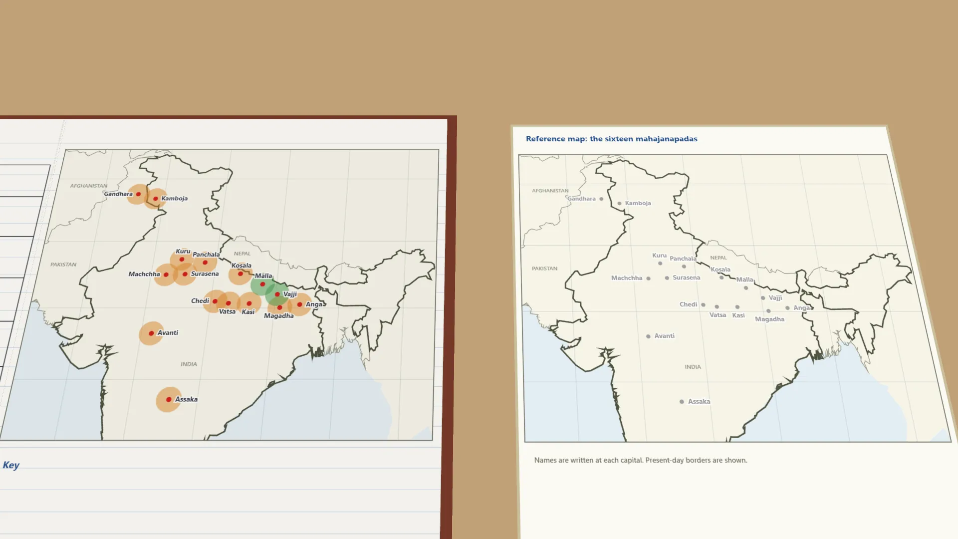
- Using the reference map, mark where each of the sixteen mahajanapadas was on the outline map.
- Mark a small red dot for each capital, e.g. Rajagriha for Magadha and Ujjayini for Avanti.
- Shade the monarchies and the gana-sanghas (republics) in two different colours.
- With an atlas, find the present-day state or city nearest each ancient capital.
- Record your findings for at least six mahajanapadas in the observation table.
- Draw a simple key on your map showing the colours used.
Interactive 3D Experiment
Loading simulation…
What to observe
- Most mahajanapadas lay on the Ganga plain, in today's Uttar Pradesh and Bihar.
- Fourteen were monarchies, ruled by kings; only Vajji and Malla were gana-sanghas.
- Gandhara reached into today's Pakistan; Avanti and Assaka lay further south.
- Many ancient capitals are near cities we know today, like Varanasi, Ujjain, Mathura and Delhi.
Notes
- Social Science Spark: only two mahajanapadas, Vajji and Malla, were gana-sanghas, where the sabha or samiti chose the ruler by discussion and vote - among the earliest known republics in the world.
- Use a sharp pencil for accurate map outlines.
- Check the atlas carefully before marking present-day places, and keep the colour key the same across the map.
- The list of mahajanapadas and capitals follows the standard NCERT list, as the chapter's map is not on the lab-manual page. Some capitals' sites are debated.