
Mapping the Geography of Indian Architecture
Aim
To mark the locations of architectural structures from the chapter on an outline map of India, using a symbol legend, and to identify regional patterns.
Apparatus
- An outline political map of India
- A pencil and coloured pencils
- An atlas for reference
- The textbook's map of structures and monuments (Fig. 3.3)
Procedure
- Draw a legend with a symbol for each kind of building (a triangle for temples, a dome for mosques).
- Pick a structure card and decide which kind of building it is.
- Find the structure's state on the map and mark its symbol at its place.
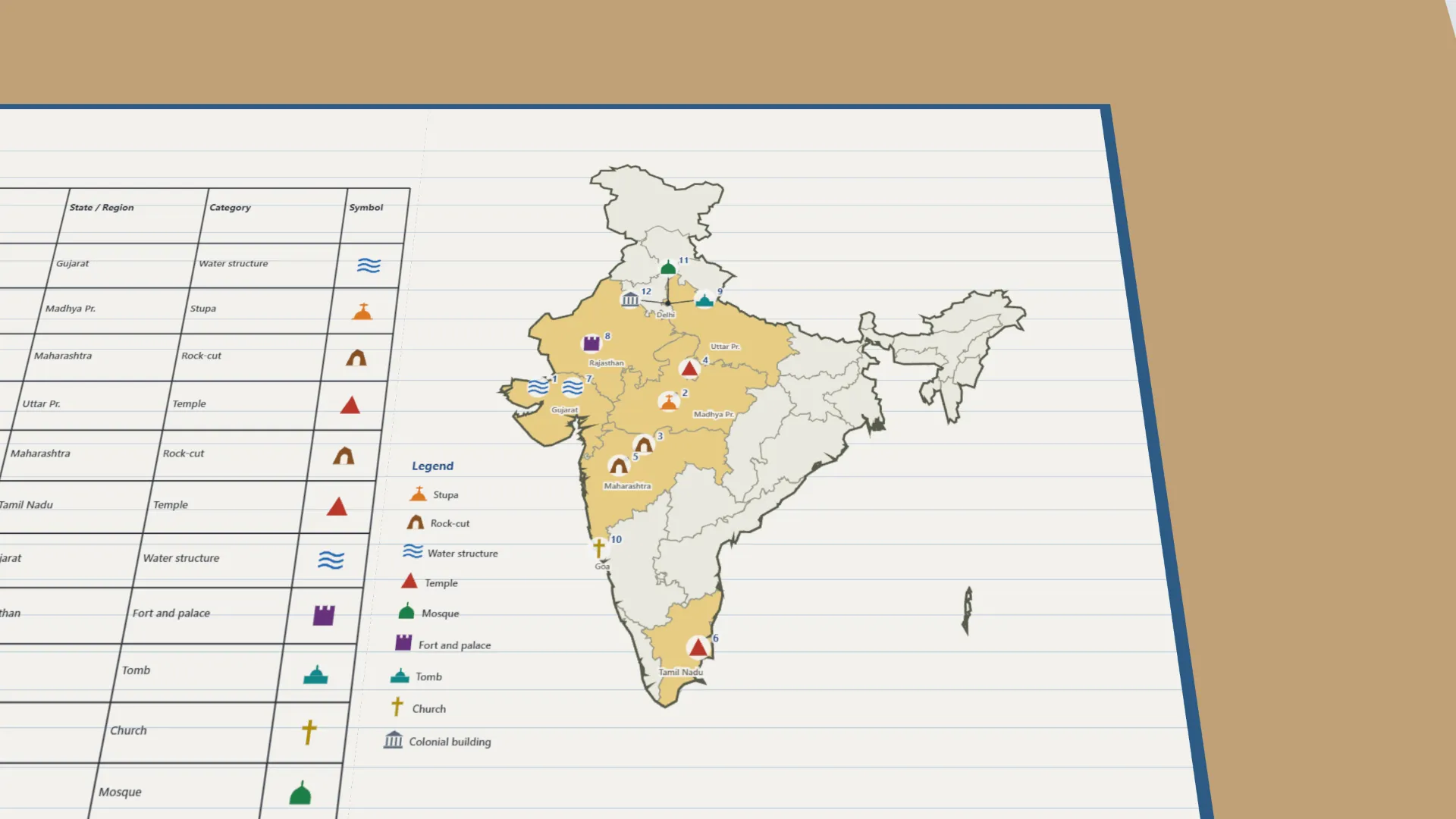
- Record the structure, its state, its category and symbol in the table. Repeat for all twelve.
- Circle every state that has three or more structures — an architectural cluster.
- Write the regional patterns you see on your map.
Interactive 3D Experiment
Loading simulation…
What to observe
- The twelve structures are spread across India, from Delhi to Tamil Nadu and from Gujarat to Uttar Pradesh.
- Delhi is the only cluster — a tomb, a mosque and a colonial building — because it was a capital for centuries.
- Rock-cut caves group in the Deccan (Maharashtra); water structures in dry Gujarat; temples from north to south.
Notes
- Precaution: use an atlas to confirm state boundaries; keep symbols consistent with the legend throughout the map.
- The twelve structures are the same as in the classified timeline practical; their places are standard facts, because the textbook's Fig. 3.3 is not on the lab-manual page.