
Mapping the Many Names of Bharata
Aim
To identify ancient regions named in the Mahābhārata, find where they lie on an outline map of India today, and see how Bhāratavarṣha came to describe the whole Subcontinent.
Apparatus
- An outline political map of India
- An atlas
- Coloured pencils
- A copy of the region map from the textbook (Fig. 5.4)
Procedure
- Study the map of regions in the Mahābhārata in your textbook and choose any six regions.
- Use an atlas to find the present-day state or area that matches each ancient region.
- On your outline map, mark and label each region with its ancient name and shade it lightly.
- Beside each shaded region, write its present-day name in a different colour.
- Draw the Vishnu Purana boundary, north of the ocean and south of the snowy mountains, round your map.
- Compare your map with a partner's and talk about the regions you each chose.
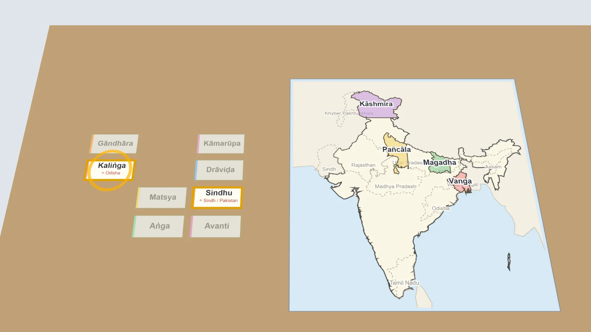
Interactive 3D Experiment
Loading simulation…
What to observe
- The ancient regions lie all over the Subcontinent, from Gāndhāra in the north-west to Kaliṅga in the east and Drāviḍa in the south.
- Together they show how Bhāratavarṣha described the whole land as one.
Notes
- The Mahābhārata names dozens of regions spread across the whole Subcontinent, from Gāndhāra in the north-west to Kaliṅga in the east and Pāṇḍya in the far south. This wide spread is one clue that ancient Indians thought of the land as a single, connected geography long before modern borders existed.
- Use the atlas carefully when matching ancient and modern names, because boundaries have changed a great deal. Label all regions neatly and keep the map to scale where possible.