
Mapping India's Specialised Urban Centres
Aim
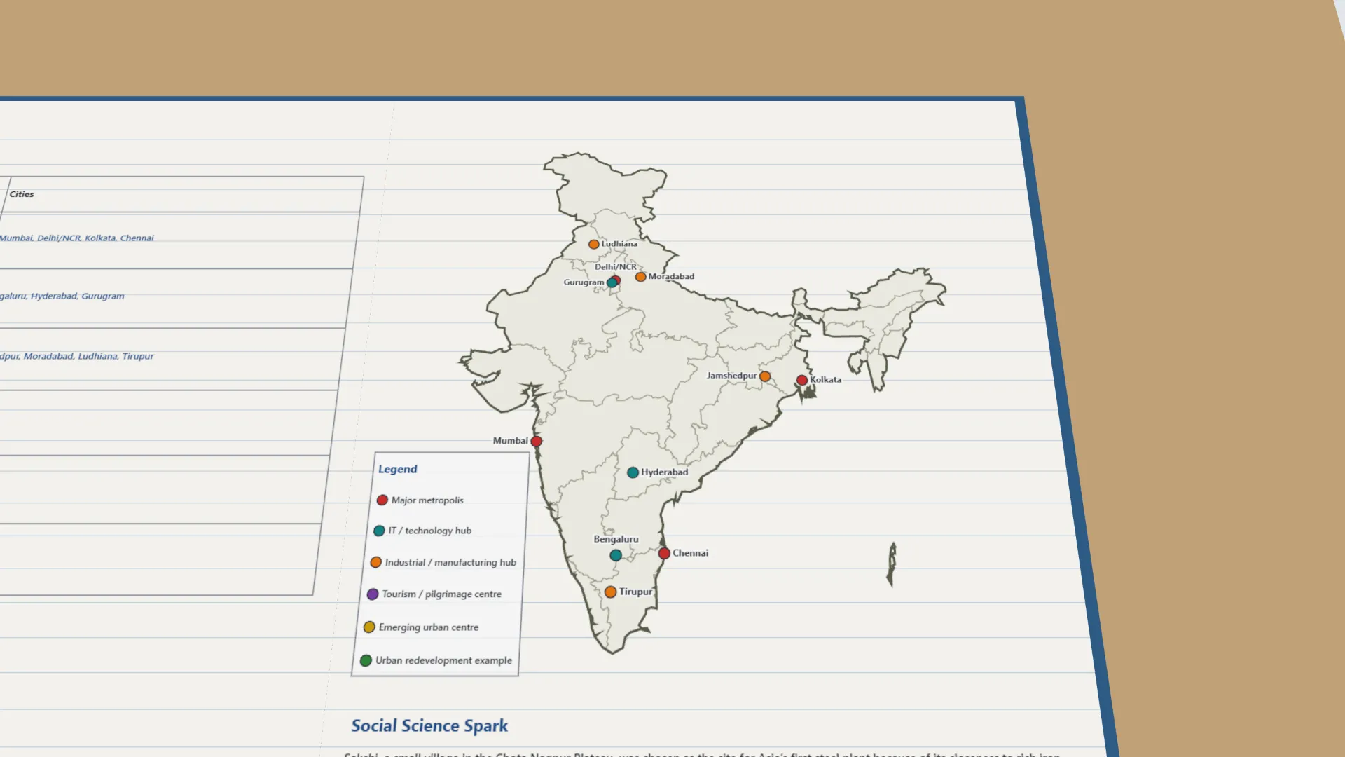
To locate India's major urban centres on an outline map and classify them by their main economic specialisation, using coloured dots and a legend.
Apparatus
- An outline political map of India
- An atlas
- Coloured pencils
- A ruler
Procedure
- Draw a legend box with one colour for each of the six categories of city.
- Read what a city is known for and decide which category best describes its main role.
- Find the city on the map, mark it with a dot of its colour and label it. Repeat for all 23 cities.
- Compare with the sample map. Discuss why clusters (e.g. textiles in Punjab, Tamil Nadu) grew there.
Interactive 3D Experiment
Loading simulation…
What to observe
- Mumbai, Delhi/NCR, Kolkata and Chennai are major metropolises: centres of money, trade and government.
- Bengaluru, Hyderabad and Gurugram are IT hubs; many crafts and industries cluster in one city each.
- Textile cities are in Punjab (Ludhiana) and Tamil Nadu (Tirupur).
- Cities grow around an advantage, such as iron ore near Jamshedpur, old craft skills, a port or the capital.
Notes
- Social Science Spark: Sakchi, a village on the Chota Nagpur Plateau, was chosen for Asia's first steel plant because rich iron ore lay close by. It was renamed Jamshedpur in 1919.
- Precaution: use a sharp pencil, keep the legend colours the same throughout, and check each city in the atlas before marking it.
- What each city is known for, its state and its place use standard facts, because the chapter's descriptions are not on the lab-manual page.