
Mapping India’s Soils and Their Crop Linkages
Aim
To identify and shade the major soil types of India on an outline map, and to match each soil type with the states and crops associated with it.
Apparatus
- An outline political map of India
- An atlas or the soil-type map from the textbook (Fig. 1.9)
- Colour pencils
- A ruler
- A soil-crop reference chart (Fig. 1.10)
Procedure
- Choose a soil type and add its colour to the legend in one corner of the map.
- Shade the states or union territories where this soil is found, and label them.
- List two major crops grown on this soil.
- Decide whether the soil's fertility is high, medium or low.
- Fill in its row of the observation table.
- Mark with an asterisk (*) a crop that grows here only with the help of irrigation.
- Read the Social Science Spark about black soil.
Interactive 3D Experiment
Loading simulation…
What to observe
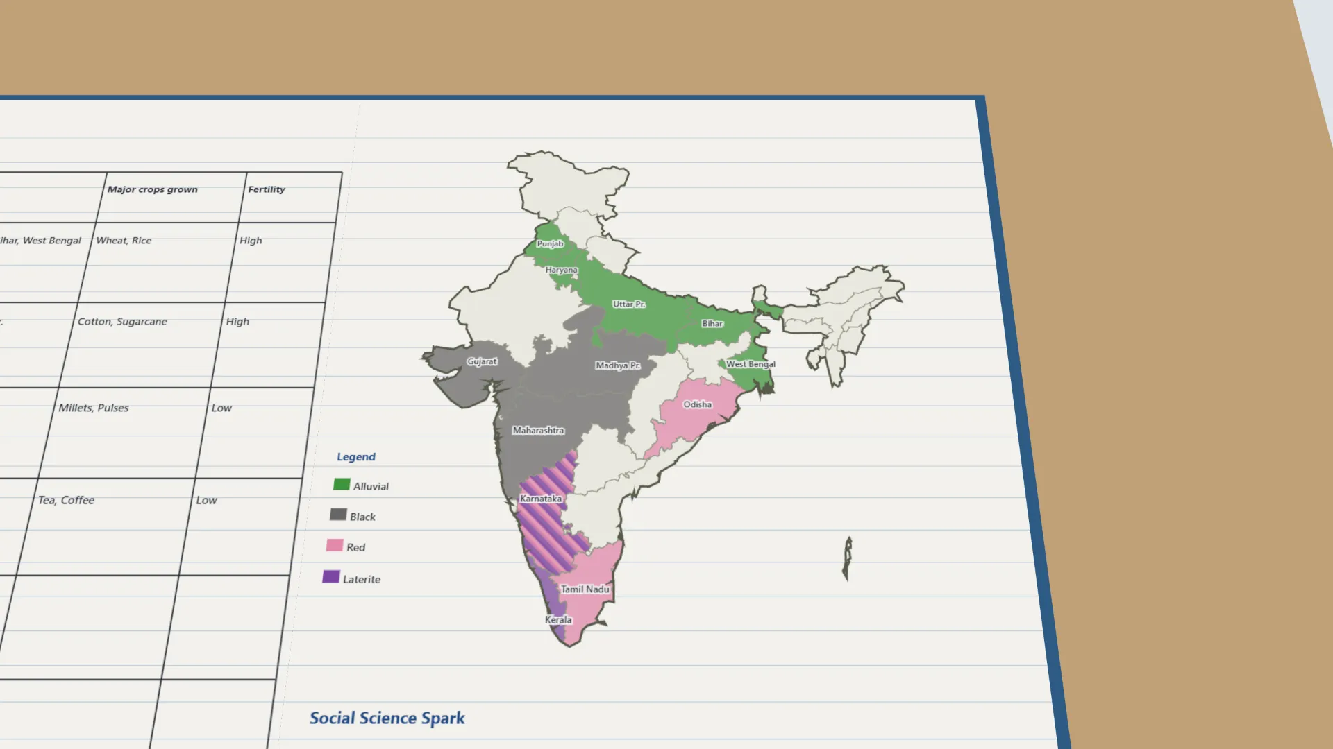
- Alluvial soil covers the northern plains (Punjab to West Bengal) and grows wheat and rice.
- Black soil of Maharashtra, Gujarat and Madhya Pradesh holds moisture and suits cotton.
- Red and laterite soils of the south are less fertile; laterite suits tea and coffee.
- Wheat grows in Rajasthan's desert soil only with irrigation.
Notes
- Precaution: do not confuse red soil with laterite soil - both look reddish. Karnataka has both.
- The states, crops and fertility follow standard NCERT facts because the textbook's soil map and chart are not on the lab-manual page.