
Mapping India’s Migrant Communities
Aim
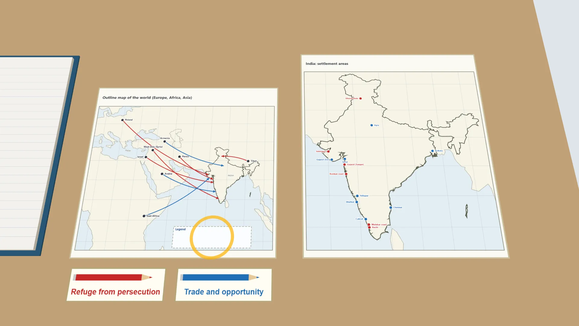
To locate, on a world map, the regions of origin and the Indian settlement areas of communities described in the chapter, and to classify each as having come mainly for refuge or for trade and opportunity.
Apparatus
- An outline map of the world
- An atlas
- Colour pencils
- Thread or sketch pens to mark routes
Procedure
- On the world map, mark the region each community came from, from Israel to Tibet.
- On the India map, mark where each community settled, from the Konkan coast to Dharamshala.
- For each community, draw its route from its homeland to India in one of two colours.
- Prepare a legend - one colour for refuge from persecution, one for trade and opportunity.
- Record your findings for eight communities in the observation table.
Interactive 3D Experiment
Loading simulation…
What to observe
- Communities reached India from Europe, Africa, West Asia and Tibet, by sea and over land.
- The Parsis, Bene Israel Jews, Syriac Christians, Polish refugees and Tibetans came for refuge from persecution or war.
- Arab merchants, Siddis and Armenians came with trade and in search of work.
- Many settled on the western coast, where ships from West Asia and Africa landed.
Notes
- Social Science Spark: India today has the largest population of Zoroastrians in the world, though the faith began in ancient Persia.
- Use an atlas to place each region and settlement area.
- Keep the legend consistent and label the routes neatly.
- The routes are approximate; the simulation shows the India part of the world map on a second sheet so the towns can be told apart.