
Mapping India’s Land and Maritime Neighbours
Aim
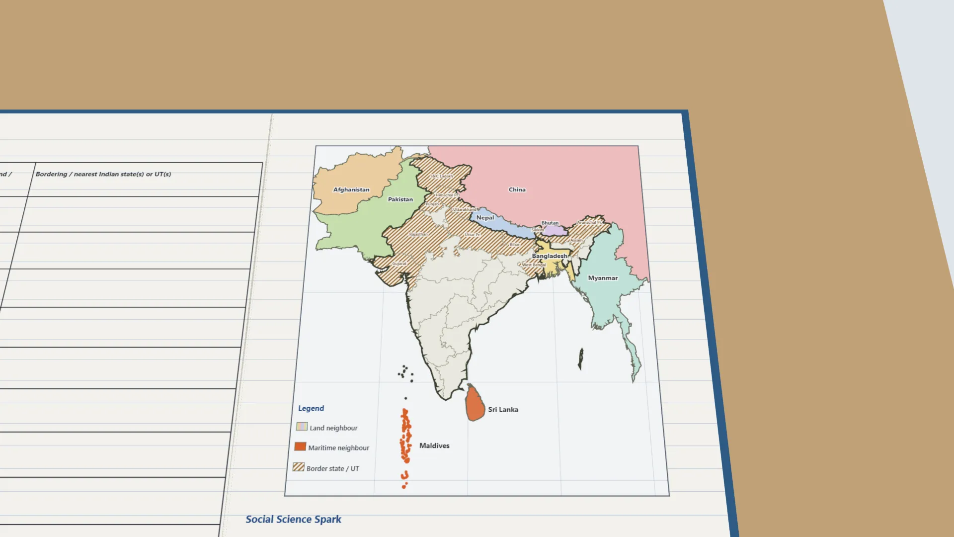
To locate India’s land-based and maritime neighbours on an outline map, and to identify the Indian states or Union Territories that border or lie nearest to each of them.
Apparatus
- An outline map of India and her neighbourhood (South and Southeast Asia)
- An atlas
- Colour pencils
- A ruler
Procedure
- Shade and label India’s seven land neighbours, each in a light colour.
- In a contrasting colour, mark the two nearest neighbours across the sea.
- For each neighbour, find the Indian states or UTs on its border, or nearest to it.
- Draw a compass rose; mark the distance across the Palk Strait and from Minicoy to the Maldives.
- Record each country in the table as ‘Land’ or ‘Maritime’, with its states or UTs.
- Read the Social Science Spark.
Interactive 3D Experiment
Loading simulation…
What to observe
- India has seven land neighbours - Pakistan, Afghanistan, China, Nepal, Bhutan, Bangladesh and Myanmar.
- Sri Lanka and the Maldives are India’s neighbours across the sea.
- Only Ladakh touches Afghanistan; West Bengal borders three countries.
- Sri Lanka is about 55 km from India across the Palk Strait; the Maldives about 130 km from Minicoy.
Notes
- Social Science Spark: India’s land boundary is over 15,100 km long and its coastline about 11,100 km, so India has both land and maritime neighbours.
- Precautions: check the borders in an atlas before shading; label neatly and use a legend for your colours.
- The neighbours’ borders and states follow standard official facts (Survey of India, Ministry of Home Affairs), as the textbook’s map is not on the lab-manual page.