
Mapping India’s Infrastructure Marvels
Aim
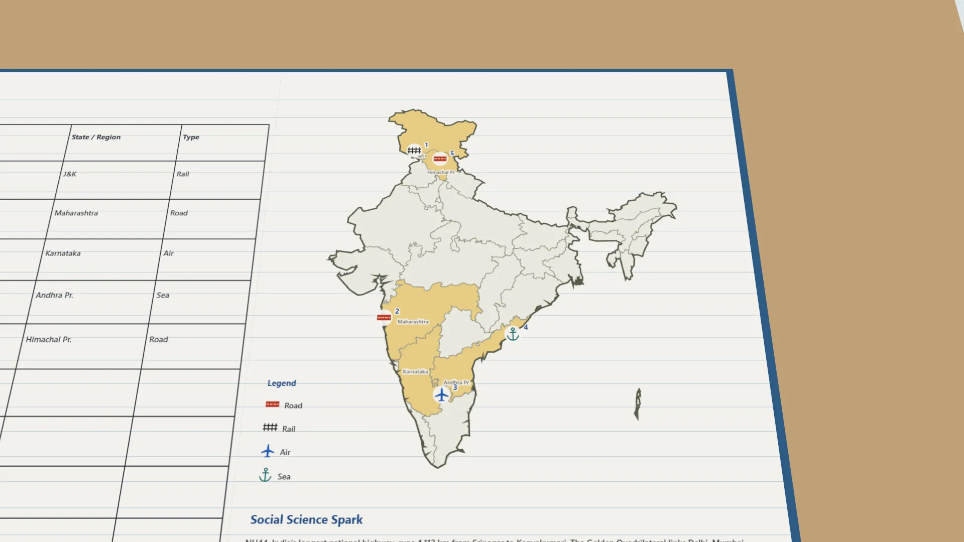
To locate major transportation infrastructure landmarks of India on an outline map, and to classify each as road, rail, air or sea infrastructure.
Apparatus
- An outline political map of India
- A set of Infrastructure Landmark Cards
- A legend (key) of symbols for road, rail, air and sea
- Coloured pencils
Procedure
- Draw a legend on the map with four symbols, one each for road, rail, air and sea.
- Read a landmark card and decide whether it is road, rail, air or sea infrastructure.
- Find the landmark's state on the map and mark its symbol at its place.
- Record the landmark, its state and its type in the table. Repeat for every card.
- Count each type. Discuss which type appears most often, and why.
Interactive 3D Experiment
Loading simulation…
What to observe
- The landmarks are spread across India, from Jammu & Kashmir to Tamil Nadu and from Gujarat to Assam.
- Bridges and tunnels can be road or rail; airports are air and ports are sea infrastructure.
- Road appears most often, because roads reach almost every part of India, even hills and remote areas.
Notes
- Social Science Spark: NH44, India's longest national highway, runs 4,112 km from Srinagar to Kanyakumari. The Golden Quadrilateral links Delhi, Mumbai, Chennai and Kolkata.
- Precaution: mark symbols neatly at the approximate correct location; use the textbook maps instead of guessing.
- The nine landmark cards use standard official facts, because the textbook's maps are not on the lab-manual page.