
Mapping India’s Climate Hazards
Aim
To find the regions of India most affected by cyclones, floods, landslides and forest fires, and to tell apart the natural and human causes behind each disaster.
Apparatus
- Science notebook or lab record and pencil
- Outline map of India
- Coloured pencils or sketch pens (at least four colours)
- Chart paper for the class disaster map (optional)
- The list of disaster-prone states given in the chapter
Procedure
- Choose one climate-related disaster - cyclones, floods, landslides or forest fires.
- On the outline map of India, shade the states prone to it, one colour per disaster.
- Find one natural cause and one human-linked cause that make it more likely or worse.
- Note two preventive measures that could reduce its harm to people and property.
- Fill in its row of the table and present your map and findings to the class.
- Combine all the maps to see which regions face more than one climate hazard.
- Conclude why knowing both the natural and the human causes helps reduce a disaster's harm.
Interactive 3D Experiment
Loading simulation…
What to observe
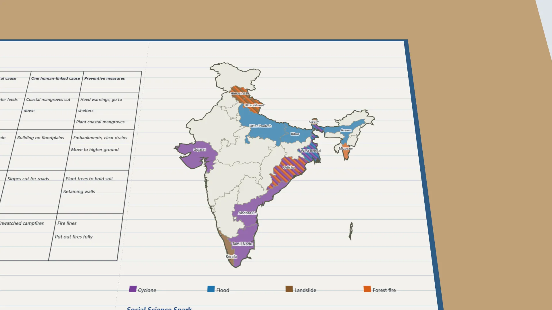
- The east coast (Odisha, Andhra Pradesh, Tamil Nadu, West Bengal) and Gujarat are hit by cyclones.
- Floods strike the river plains of Assam, Bihar, Uttar Pradesh and West Bengal.
- Hill states face landslides; Odisha, West Bengal, Himachal Pradesh and Uttarakhand face two hazards.
- Every disaster has natural causes, and human actions can make it more likely or worse.
Notes
- Social Science Spark: the calm, cloudless centre of a cyclone is called the 'eye of the storm' - it can be strangely still while fierce winds circle around it.
- The states, causes and measures follow standard facts (NDMA, IMD) because the chapter's list is not on the lab-manual page.