
Mapping the Dynasties of the 11th and 12th Centuries
Aim
To locate the major dynasties of northern, central and southern India in the 11th and 12th centuries on outline maps, and to match each dynasty to its capital and to a monument it is remembered for.
Apparatus
- Two outline maps of India (north and centre; south)
- An atlas
- Colour pencils
- A reference list of dynasties and monuments
Procedure
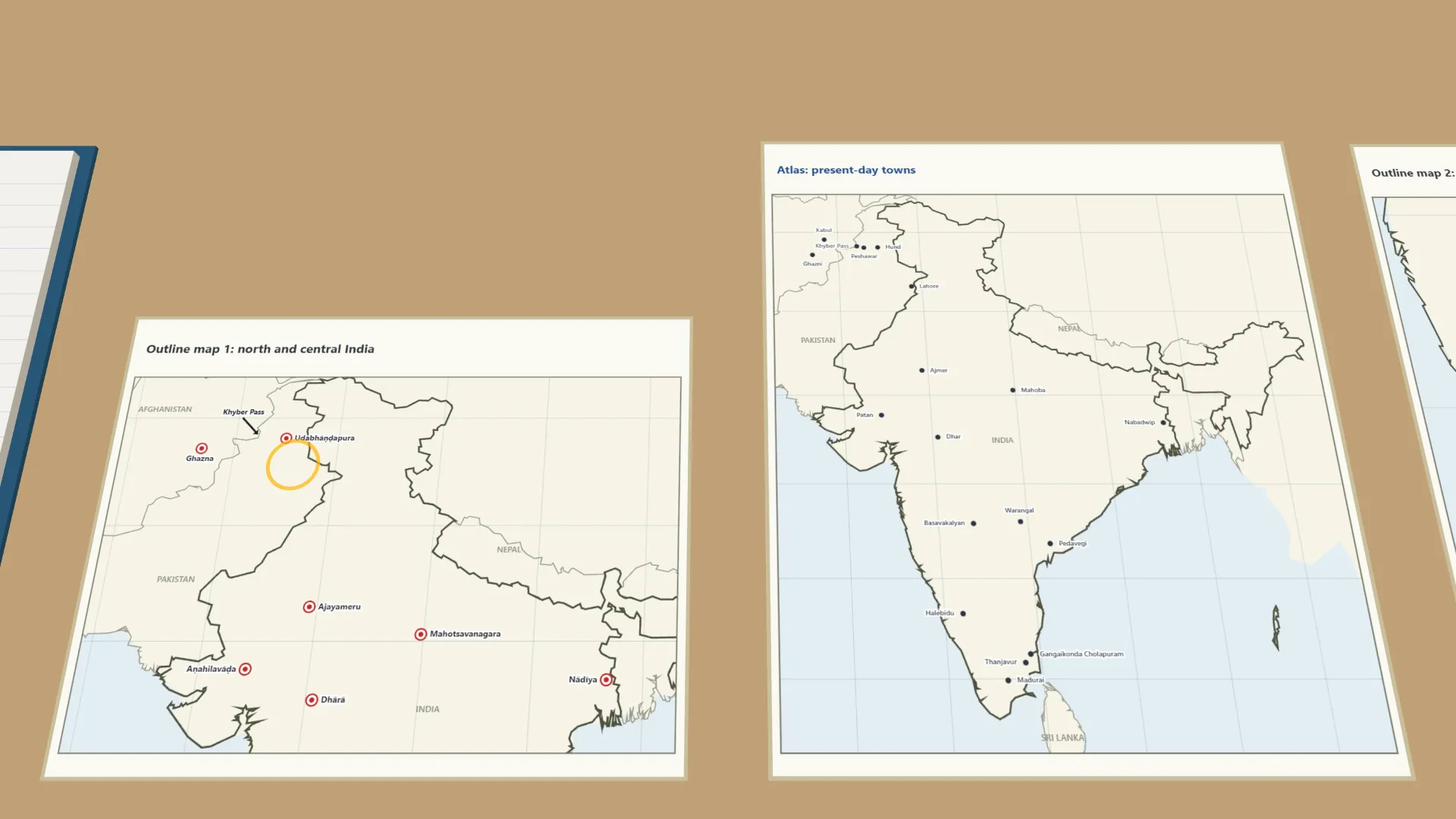
- On the north map, mark the capitals of seven dynasties, from Ghazna to Nādīya.
- On the south map, mark the capitals of six dynasties, from Kalyāṇī to Madurai.
- Mark the Khyber Pass with an arrow and draw the route Mahmūd of Ghazni took into India.
- Use the reference list to match each dynasty to a monument, e.g. the Cholas and the Bṛihadīśhvara temple.
- Record your matches for nine dynasties in the observation table.
Interactive 3D Experiment
Loading simulation…
What to observe
- In the 11th and 12th centuries many dynasties ruled at the same time, each from its own capital.
- The Ghaznavids ruled from Ghazna, beyond the mountains; Mahmūd entered India through the Khyber Pass.
- In the south, the Cholas ruled from Tanjāvūr and later Gangaikoṇḍacholapuram.
- Each dynasty built temples, forts or lakes near its capital, like the Bṛihadīśhvara temple of the Cholas.
Notes
- Social Science Spark: the Khyber Pass was both a gateway for invading armies and a trade route to Central Asia.
- Use an atlas to place each capital as accurately as you can.
- Label neatly and use the same symbol for capital cities on both maps.
- Capitals are shown at today's towns (Ajayameru is Ajmer, Dhārā is Dhar, Orugallu is Warangal).