
Mapping the Harappan Cities and Analysing Town-Planning
Aim
To find the main sites of the Indus-Sarasvatī Civilisation on an outline map, and to understand the upper town and lower town layout of Harappan cities from a labelled diagram.
Apparatus
- Outline map of the Indian subcontinent
- An atlas
- Pencil
- Coloured pencils
- Ruler
Procedure
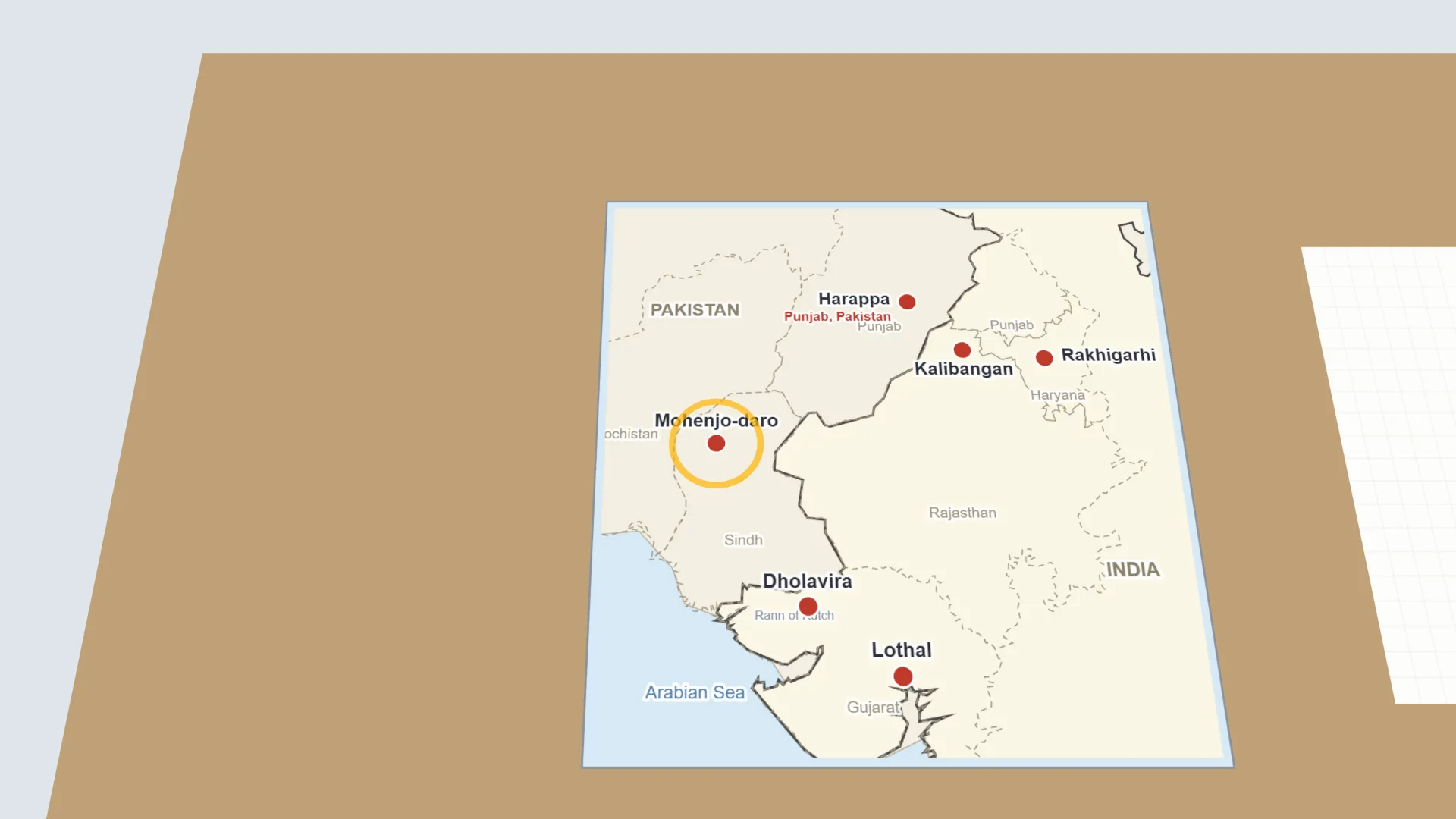
- On the outline map, mark and label Harappa, Mohenjo-daro, Dholavira, Rakhigarhi, Kalibangan and Lothal.
- Use an atlas to find the modern state or country of each site and write it beside the site name.
- Draw the River Indus and its tributaries, and the dried-up Sarasvatī River as a dotted line.
- On a separate sheet, draw a simple plan of a Harappan city with an upper town, a lower town, a boundary wall and wide streets.
- Label the parts of your plan and shade the upper town and the lower town in different colours.
- Write your site-mapping data in the observation table.
Interactive 3D Experiment
Loading simulation…
What to observe
- The Harappan sites lie along and between the Indus and the dried-up Sarasvatī, in Pakistan and in India.
- Harappan cities were planned: an upper town, a lower town, a boundary wall and wide streets facing the cardinal directions.
Notes
- Dholavira, in Gujarat, is unique among Harappan cities. It had three distinct zones instead of the usual two, and its buildings had stone foundations instead of only bricks.
- Use a sharp pencil for accurate map outlines. Look at the atlas carefully before marking, and label neatly so that dots and names do not overlap.