
Constructing a Grid-Reference Map of Oceans and Continents
Aim
To construct a grid over a schematic world map, and to use grid references to record the position of continents (landmasses) and neighbouring oceans.
Apparatus
- Graph paper
- A printed outline / schematic world map
- Ruler
- Pencil
- Coloured pencils
- An atlas for reference
Procedure
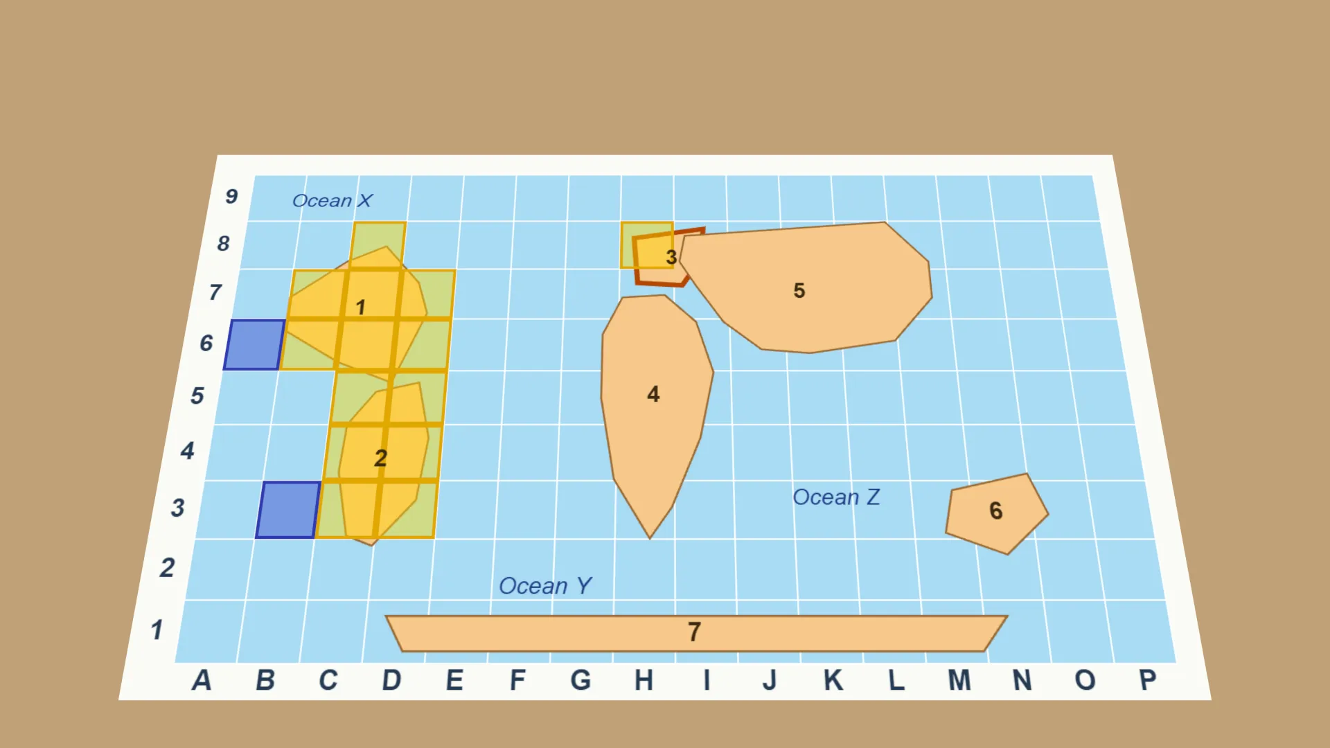
- Study the schematic grid map. Each shaded landmass sits inside a lettered and numbered grid (columns A to P, rows 1 to 9).
- Find the grid squares each landmass occupies and write down its grid references, for example C6–C7.
- Find the grid squares of the nearest open (unshaded) area, which is ocean, and record its grid reference.
- Record your findings in the observation table.
- Swap your table with a partner. Check whether your grid references match, and re-check the map together if they differ.
Interactive 3D Experiment
Loading simulation…
What to observe
- Every grid reference is a column letter first, then a row number.
- A large landmass covers many squares, so its references are written as runs such as C6–C7.
- Open squares beside a landmass are ocean.
- Grid references work like latitude and longitude. They describe the exact position of places.
Notes
- Grid references are the working principle behind latitude and longitude. Geographers, sailors and disaster-response teams use them to describe the exact position of oceans, continents and coastlines.
- Read grid references the same way every time, column letter followed by row number. Use a sharp pencil and keep labels easy to read.