
Constructing a Political Timeline and Map of Early Medieval India
Aim
To make a timeline of the major dynasties and rulers of the 6th to 10th centuries, and to mark their kingdoms on an outline map of India, to understand the political landscape of this period.
Apparatus
- An outline political map of India
- An atlas or the textbook maps (Fig. 3.3 and Fig. 3.16)
- Colour pencils
- Chart paper
- A ruler
- Sketch pens
Procedure
- Use the atlas to find each power's region. Shade it on your map in its own colour.
- Make a key (legend) for the colours on your map.
- Mark Kannauj with a star - three powers fought over it.
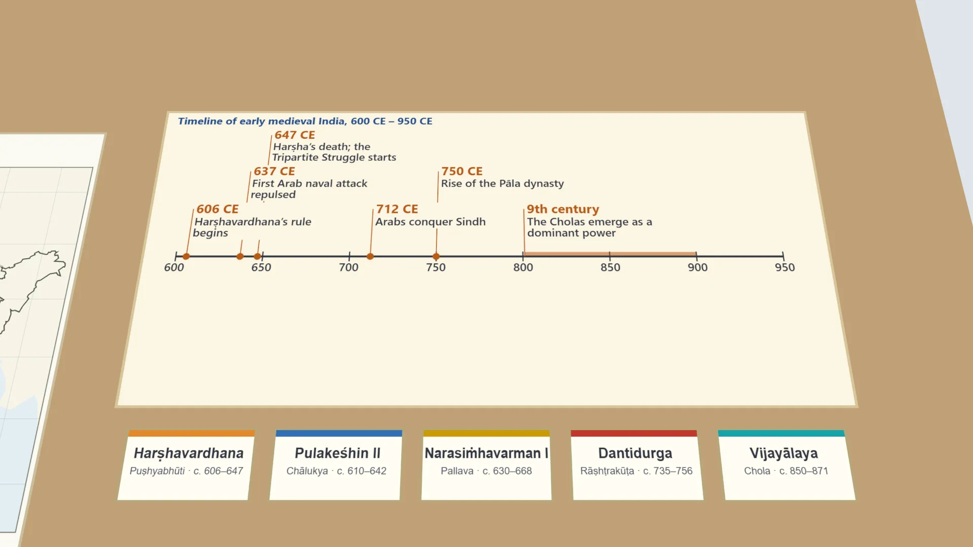
- On a strip of chart paper, draw a timeline from 600 CE to 950 CE.
- Mark the six events at their years, from 606 CE to the 9th century.
- Beside three rulers of your choice, note one achievement each.
- Fill in the table. Discuss why Kannauj attracted so many rival powers.
Interactive 3D Experiment
Loading simulation…
What to observe
- Many regional powers ruled India at the same time - in the north, the east, the Deccan and the far south.
- Kannauj lay in the rich Ganga plain, between the Pālas, the Gurjara-Pratīhāras and the Rāṣhṭrakūṭas.
- After Harṣha's death in 647 CE these three powers fought over Kannauj (the Tripartite Struggle).
- The Pālas rose around 750 CE; the Cholas became a strong power in the 9th century.
Notes
- Social Science Spark: the Tripartite Struggle for Kannauj lasted on and off for nearly two centuries, yet no power won it for good.
- Follow the atlas or textbook map while marking regions.
- Keep the timeline entries in the correct order of time.
- Use a sharp pencil before inking the final map.
- The regions are approximate, following the NCERT maps; the textbook's figures are not on the lab-manual page.