
Comparing the Sizes of Continents by Square-Counting
Aim
To compare the relative sizes of the seven continents by counting unit squares in a scaled diagram, and to rank them from largest to smallest.
Apparatus
- The square-grid diagram
- Pencil
- Notebook
- Coloured pencils (optional)
Procedure
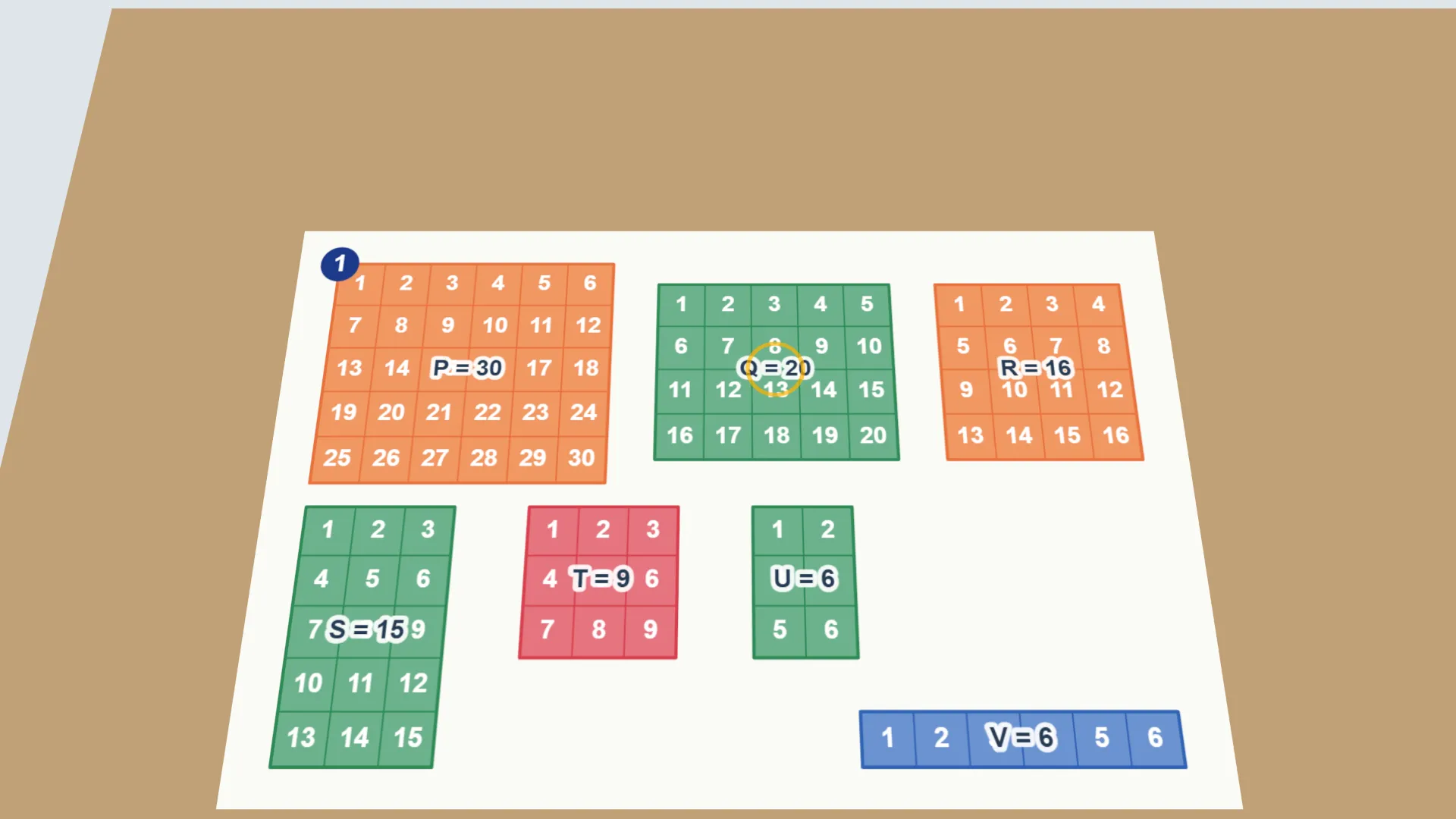
- Look at the diagram. Each continent is a block made of equal unit squares.
- Count the squares in each block, and record the number in the observation table.
- Rank the continents from 1 (largest number of squares) to 7 (smallest).
- Discuss with a partner. If any two continents were combined into one block, how would the ranking change?
- Compare your ranking with the actual order of continents by area, using an atlas.
Interactive 3D Experiment
Loading simulation…
What to observe
- The block with the most squares is the largest. Two blocks can have the same number of squares.
- Combining two blocks makes a bigger block, so the ranking can change.
Notes
- Square-counting is a simple but powerful technique that geographers once used to estimate the area of irregular shapes on maps before digital tools existed. Counting unit squares (and estimating part-squares) gives a quick approximation of relative size.
- Count each square only once. For irregular edges, estimate part-squares consistently (for example, count a part-square only if more than half is filled).
- The labels P to V are for practice. They are not the real continents.